Timescapes Maps Handbook
Timescapes Maps Handbook
Desktop Version
All written content © Kevin Mills 2015
history maps
- FULL COLOUR MAPS OF THE ANCIENT WORLD
- OVER 1500 SITES WITH POP-UP INFO CARDS, IMAGES, VIDEO AND WEBLINKS
- DIGITAL SO CAN BE VIEWED AS BIG OR AS SMALL AS YOU NEED • INSTANT UPDATES
- 3-DIMENSIONAL
- ULTRA HIGH MAGNIFICATION
- MODULAR / OPEN SOURCE : MAPS CAN BE RECONFIGURED AND CUSTOMIZED
- NETWORK LINKING FOR SMALL FILESIZES AND FASTER LOADING TIMES • ADDITIONAL MAP PACKS AVAILABLE (BATTLES, GEOGRAPHIC FEATURES ETC)
- BUILDS INTO A GIANT OPEN-ENDED DATABASE / SITE LIBRARY
AUTHOR’S NOTE
The Timescapes project was born from a desire to view the contemporaneous growth of the cultures of our ancestors in a visual way that until now has not been available, whilst providing fast and comprehensive access to the associated written information. I created the maps for myself, in order to better understand the progress and decline of ancient civilisations from the earliest city-states, and to assess these cultures in a temporal relation to one another.
As the project became more detailed, I thought it would be a useful way for other people to see it too. I’m very happy and flattered if the maps are used as an educational tool – I must emphasise though that they are not intended to be any kind of definitive or conclusive statement on the factual boundaries or extent of these cultures, merely informed conjecture (although years of research has gone into the creation of the maps). In fact, the maps are very much works in progress – the point is that they can be updated and improved as new archaeological discoveries re-define existing knowledge.
Use this Handbook and the Timescapes User Guide to make the settings and layers within Google Earth Pro work for you. Enable the aspects you need and disable those you don’t. I hope you find it as educational and inspiring to use as I did while creating it. Enjoy.
Kevin Mills, Timescapes creator
TABLE OF CONTENTS
PART ONE
INTRODUCTION
Will Durant
Ever since humans began to wander further than the confines of their villages or tribal territories, they have relied on maps: before writing materials directions were drawn in cave sand, relayed by word and divined from the sun and the star constellations in the night sky. Then came clay tablets, papyrus sheets and the invention of writing: soon maps were portable objects. For thousands of years they have been items designed for one purpose: to aid physical navigation. They still do, on mobile phones everywhere.
Historical maps are also functional, in the sense of providing a visual context for an understanding of the progress of earlier cultures.
The map occupies a special place in the appreciation of history. It provides a unique vantage point of the human world from space, and by doing so, it enables the simultaneous viewing of thousands of specific points of interest.
CONCEPT
Think of a 2-dimensional atlas in conventional book form. If you are, or have ever been, a history student, then you will have used atlases for reference. They are often quite beautiful things, with nice illustrations and useful guides to facts and figures.
They are also large and heavy, so not ideal to carry around with you. Plus they are limited in scope due to the physical limitations of the page. In other words, you can only cram so much information onto printed pages before you run out of space.
And one of their biggest drawbacks is that they are frozen in print: they can’t update themselves to take on board new archaeological and historical discoveries. They can’t take advantage of new technological developments. They can’t stack up infinite layers of information relating to different aspects of history.
Now imagine a 3-dimensional digital atlas that allows extreme magnification from outer space to ground level. That can open any number of maps of the ancient world – maps in which all the sites of the modern world have been replaced with their ancient counterparts. Plus cities that are now in ruins. Plus proposed locations of lost cities. Plus info pop-ups for every site, with images, video content, original written content, weblinks and name variations, which together constitute the most comprehensive exploration of the ancient world ever assembled.
Each element of a map can be switched on and off in the Google Earth sidebar. Different map elements (cities, borders, colours) can be freely organised into different folders and sub-folders which form a customisable drop-down menu. This enables the user to group elements of their choice together and to be able to show or hide specific blocks of information.
Welcome to Timescapes History Maps: a series of digital historical timeline maps developed for use in Google Earth Pro. A colossal project that has taken years of research and construction in order to bring a universe of historical information to your fingertips. And the whole thing fits on a flash-drive smaller than your thumb.
Google Earth Pro is an ideal platform for Timescapes as it uses the common .kml/.kmz file format which can be easily viewed across multiple versions of Google Earth Pro on all platforms.
Google Earth Pro also uses high resolution satellite imagery to render a 3-dimensional map of our earth with which the user is able to interact. Onboard features, e.g. high-magnification zooming and 3D rotation, allow the user to appreciate in detail the nature of the geographical terrain associated with any given culture, for example the mountain ranges of Anatolia or the deserts of Egypt.
ABOUT THE MAPS
Timescapes Series One covers the ancient Near East and spans the period between the first cities (3500 BC) to the death of Alexander The Great (323 BC) The project currently features around 1500 sites of the ancient Near East, and there are new sites being added as archaeology reveals more of history’s secrets.
The maps serve as a portal to a vast resource of region-specific information online: archaeological data, photo and video links and map overlay data, all of which contribute to a detailed understanding of these early cultures and their progress through history.
Timescapes Series Two is also planned, picking up where Series I ends.
Except the Timescapes Project never really ends. That’s the beauty of it. Unlike the conventional books we still love, Timescapes can be updated at a moment’s notice. Additional sites and information are added as soon as they become available, eventually building into a huge resource for students, historians, scholars, archaeologists, educators and anyone who has a passion for, and sense of wonder about, history.
The maps run on Google Earth Pro (desktop version for Mac and Windows).
By drawing on the huge body of existing archaeological, historical and geographical data, the intent is to build a library of timeline maps and associated information which strive to visually illustrate as accurately as possible the extent and influence of past cultures.
Timeframes of the maps
Timescapes is designed to give the user a broad overview of the progression of cultures through time, by using complex snapshots, as it were, of specific points in time. Each map is designed to illustrate a specific year on the historical timeline. Sometimes the year will be chosen to reflect significant events, e.g. the collapse of a culture or the point at which it reached its greatest extent. Other years may be chosen to represent the general composition of the Near East.
The maps are currently spaced apart in time periods of roughly 50 – 150 years. Often, depending on significant events or periods, they will be closer together or further apart in time. The very first maps are spaced much further apart, reflecting the paucity of available data for this early period.
CREATING THE MAPS
If you were creating 20th century maps covering the time period of, say, Germany between the wars, it would be relatively easy to achieve a high degree of accuracy due to the fact that the period in question is very well documented statistically, geographically and historically. The same is not true of the ancient world: the absence of information means that much of the data in maps of the ancient past is necessarily conjecture. That data is, however, the result of years of intensive research based on the currently available archaeological and historical record.
Accuracy
The Timescapes project will always strive for optimum accuracy based on the historical sources and will evolve and refine the maps over time as new data becomes available. Arrangement of ancient boundaries will always be speculative however and no apologies are made for that. As always, Timescapes welcomes all constructive and informed contributions to the project.
There is quite a lot of information available for certain periods: for the Neo-Assyrian period, for example, a relatively accurate picture can be obtained from their many inscriptions; for other periods/ cultures, (e.g. the culture of Iron Age Luristan, which has left many fine art objects but few written records), the extent of culture or settlement may not be currently possible to determine with certainty. As always, new information is contingent on new discoveries in the fields of history and archaeology.
Geographical features
Of course the climates of certain areas have changed over the last 5000 years; the courses of some rivers have altered and shorelines have changed – but in the grand scheme of things there have been no major geological upheavals. The fact that certain geographical features like mountain ranges and many ancient roads are largely unchanged enables us to make educated guesses about things like trade routes and boundaries.
PART 2
APPENDICES:
APPENDIX 1
CONVENTIONS
1.1
REGIONS COVERED
For our purposes the designation ‘Near East’ covers the following present-day regions:
- Iran (Elam/ Persia)
- Iraq (Mesopotamia, Assyria)
- Kurdistan
- Armenia
- Syria
- Turkey
- Israel
- Palestine
- Lebanon
- Jordan
- Egypt
- Greece
- Crete
- Cyprus
Regions not covered:
- Europe (except Greece and Bulgaria)
- Arabia (except for Dilmun & Magan)
1.2
INCLUSION OF SITES & IMAGES
The criteria for inclusion of sites in the Timescapes project is relatively straightforward: the site must be historic (i.e. post-date the invention of writing), not merely pre-historic (many of course are both) and must be of significant importance irrespective of size.
There are two main types of interactive marker on a Timescapes map: Sites, represented by a yellow dot (or a yellow circle pre-2500 BC), and Icons, each of which represents a kingdom, state, nation or province.
Once a site has been established on the historical timeline, it will remain for the duration of the project. This applies even to sites which were destroyed or disappeared due to war, climate change or other factors.
Timescapes Series One is intended as a record of the earliest civilisations, a record of humankind’s earliest history. The event that separates prehistory from history is writing.
This is why our project begins in the year 3500 BC. The earliest currently accepted invention of writing dates from the inscriptions of Sumer in c. 3400 BC. There have been claims of earlier examples from ancient Egypt, but there is still scholarly debate about the transition point at which pictorial art, e.g. rock art. becomes true alphabetical writing, i.e. depiction of spoken sound.
Based on available evidence, and by the above criteria, we can currently assert that events in the ancient Near East prior to 3500 BC belong to the area of prehistory; after this point writing systems and independent alphabets begin to proliferate along with the other signs of what is commonly regarded as ‘civilisation’ in its literal sense: the development of civic systems, that is, the development of cities and large urban areas of settlement.
Prehistoric sites are very often the points from which urban settlement and expansion proceed; many modern cities such as Jericho and Damascus can trace their history of occupation back to neolithic settlements, as can well-known sites that are no longer inhabited such as the ancient cities of Eridu, Ur and Uruk.
In order to plot a coherent narrative in terms of urban development, it is necessary to represent only sites which were significant areas of population at some point after 3500 BC. With the above in mind, I have not included prehistoric sites unless they coincide with later towns or cities. Another significant detail to note is that most of the names we have for prehistoric sites are modern names, usually the current local place name. As we transition into the historical period, our included sites possess an ancient name – often not the very earliest names, which may be unknown, but at least an older name closer to the culture of the time.
I have discussed the issues of allocating names to ancient places in section 1.4 NAMING.
Images will, wherever possible, be appropriate to the general time frame of the specific map, images from earlier time periods taking precedence over those from later periods. Many sites in their earlier incarnations have no associated images; the reasons for this are various:
No artefacts were excavated from the site;
Nothing visible remains of the site itself;
The location of the site remains unknown or inconclusive;
Any available image does not enhance the appreciation of the content.
An example: the site of Apaša was once ruled by a king of Ahhiyawa, however, no material remains are extant from this period of its occupation, therefore the associated info-card contains no images. The same site from a later map though (e.g. 480 BC, when the site was named Éphesos) might contain an image of Grecian architecture.
This is to attempt to give some kind of consistency to the browsing experience and to help the maps reflect the material culture of each period. Just as the archaeological record is necessarily richer in later periods, the content of the maps will become fuller and the amount of associated media will reflect this.
1.3
Naming
Name of site in original language (e.g. Waset not Thebes).
When original name unknown, closest chronological name or name of archaeological site (e.g. Altintepe).
When both original name and closest chronological name unknown, name in common usage.
When no ancient names are known (uncommon), name of current archaeological site.
Explanation:
Wherever possible a site is named as it might have been by the culture in occupation at the time of the map, and/or the name used by the dominant linguistic culture of the time. For example, pre-Akkadian maps will often show the earlier Sumerian name for a site; post-Akkadian maps will usually show the Akkadian (more commonly used) name. So in the map of 2500 BC, the site commonly known as Lagash in English is shown as the Sumerian SIRPURLA; later it becomes the Akkadian LAGAŠ. Over the course of Series One, Greek names will gradually become more common, often replacing the Akkadian names.
Latin /Anglicised names are mostly omitted as the Roman period is outside the scope of Series One of this project.
Ancient Egyptian names are favoured over the commonly used Greek, Latin and Anglicised names (the Greek names are available as a bonus pack).
In the sidebar, however, main folders carry the commonly recognised English or Latin name. So for example, the sidebar hierarchy will show the folder GREECE; the nation icon within this folder, and as it appears on the map, carries the name HELLÁS.
There are inevitably several inconsistencies with this approach: some people will prefer the commonly used modern name and recognisable pronunciation at all times: Greek names for ancient Egyptian cities, etc. Alternate Name Packs are in the pipeline. (The Greek names for Egyptian sites are already available as a bonus pack).
Occasionally the more recognisable place name is bracketed next to the original e.g. WASET (THEBES), purely for ease of recognition. Where cultural variants or alternate names are known, they will be directly visible below the main name within the info-card balloon, which is accessed by clicking on any site on the map or in the sidebar. Generally, where the original name of the site is unknown, the info-card will say so; if the name is unattested by that specific culture, the next chronologically available name from contemporaneous sources will be used.
Sometimes another culture’s name will be favoured over the homogenous culture’s name. For example, the universally recognised BABYLṒN (the Greek name) instead of the Akkadian/ Babylonian ŠUANNA or the Sumerian KA-DINGIRRA, again purely for ease of recognition.
Timescapes attempts to stay true to linguistic traits: for example, you will see the letter Š used a lot instead of the Anglicised ’SH’, so KANESH becomes KANEŠ, LAGASH becomes LAGAŠ. You will also notice a few other diacritics, these are included as a guide to pronunciation. There is a short guide to how these sound in Appendix 1.4. As always, Timescapes welcomes suggestions for improvements or positive amendments from those of you who are specialists in ancient languages.
Many of the names are from the Ancient Greek. As the Classic age of Greek culture arrived towards the end of the period with which we are dealing (2500 BC – 323 BC) and has exerted a more comprehensive influence on European language than any of the cultures by which it was pre-dated, the Greek names tend to have ’stuck’ more than earlier names, although this is not always the case. The majority of the Greek sites in Timescapes will show a single Greek name in their associated info-card, as the names given by extraneous cultures (many of whom had died out by the time of Greek ascension) are often difficult to determine.
The locations of many ancient sites attested in the historical record remain unknown or uncertain. A question mark is used to show that a location is speculative.
There are hundreds of tells (hills or mounds) across the Near East and Central Asia which remain unexcavated and therefore as yet unidentified with ancient sites in the record. I have not marked them all, preferring to mark only those which have been excavated and identified to at least some degree of accuracy. I have also not marked Prehistoric sites or sites prior to 5000 BC unless they continued to be occupied and were attested in the historical record after 2500 BC. For a comprehensive map of Prehistoric sites, visit the excellent Megalithic Portal website here: https://www.megalithic.co.uk/
1.4
Fonts
All names in the maps are displayed in the font dictated by the setting in the Google Earth Pro Preferences section. Windows and Mac users may experience different font settings. The default font will probably be something that reads well across all platforms, e.g. Arial. In the development of Timescapes maps, Lucida Grand was used for a good balance of weight and clarity.
TIMESCAPES TIP:
For a more ‘ancient/ classical’ look, install the free Cinzel font into your system fonts folder. (if you’d like to try it, it’s available free here): https://fonts.google.com/specimen/Cinzel.
When Google Earth is next re-started, the Cinzel font should be available in the list of fonts in the drop down menu at (Top Menu) > Google Earth Pro > Preferences > 3D View > Fonts > Choose 3D font > Cinzel Medium.
1.5
Diacritics
A guide to pronunciation of some of the commonest diacritics you will encounter in the map names.
Character
Pronunciation
Š
“sh” as in “push”
Ḫ
“kh” (halfway between k and h)
Ē
“ay” as in “say”
Ğ
“j” as in “joy”
Ṣ
“ts” as in “hits”
Ṭ
“tr” as in “train” /“drain”
1.6
Map Icons
MAP OBJECTS ARE DESIGNATED BY THE FOLLOWING ICONS:
YELLOW CIRCLE: SITE, PRE-2500 BC
YELLOW DOT: SITE, POST 2500 BC
TURQUOISE DOT: EGYPTIAN SITE, POST 2500 BC
ORANGE TRIANGLE: PYRAMID
WHITE CONCENTRIC DOT: BATTLE
GREEN TRIANGLE: MOUNTAIN PEAK
WHITE CURVED ARROW: MOUNTAIN PASS
Appendix 2
USE OF CONTENT
2.1
Copyright
Written content in Timescapes is copyright © Kevin Mills 2015, unless it is quoted from other sources, in which case authors will always be credited. Please let us know if you see any content without attribution and we will rectify the omission.
Where original written content has drawn directly from or paraphrased a particular source, that source will be credited.
2.2
Images
All images used in Timescapes are in the public domain and licensed for re-use via Wikimedia Commons. All authors are credited.
All links to video content include author/ channel attribution.
Screen shot images were captured directly from Google Earth Pro.
All data stored on the Timescapes servers is original content © Kevin Mills 2015, with the exception of some public-domain images which have been edited. Where an image has been edited, it will be noted with the caption for that image.
Timescapes History Maps does not store or hold any third-party content. Any third-party content, including but not limited to, visual images, moving picture or video images and audio soundfiles accessed in the course of using any of the Timescapes History Maps is accessed purely by means of network links and via the official portal of its author (e.g. YouTube channel) or via other portals or platforms which have permission of the author to host such content (e.g. Wikimedia Commons or Wikipedia).
2.3
Links
Timescapes is intended as a information portal, and as such operates on the concept of network linking – the Info Cards (the pop-up balloons associated with every clickable element on the maps) contain multiple web links (all links are in Olive Green): the main links are to Wikipedia, there are also many other links to diverse websites. All attributions for the media content are also clickable links.
APPENDIX 3
BIBLIOGRAPHY
The bibliography is not exhaustive as the works referenced in the creation of this project run into the hundreds. However, the main sources used in the Timescapes project are contained in the bibliography, which also includes reference to non-written works such as podcasts, films and tv, audio recordings and any other relevant media.
The Bibliography is viewable here.
APPENDIX 4
ACKNOWLEDGMENTS
The following is a thank you to everyone whose online content helped to contribute to the interactive aspect of the Timescapes Project. Unfortunately, due to the scale of the project, it is not possible to list everyone here. Authors of all media referenced in Timescapes maps are credited where the media occur.
Special thanks must go to the following:
ADRIAN WHELAN
Fuelled by a steady, heady diet of Led Zeppelin and Miles Davis, Adrian is responsible for the creation and maintenance of the Timescapes Web Portal.
MARIANNE JONES
Charming dinner companion, irrepressible bon vivant and dispenser of sage advice, Marianne shared many hours of her invaluable time.
AL SMITH
A Man For All Angles. Perhaps the Devil himself, possibly merely his Advocate.
CATHY NULTER
Thanks to all the beta-testers who contributed their time and feedback. Special thanks go to Cathy for her meticulous beta-testing at various stages of the project.
WIKIPEDIA
Timescapes is heartily in favour of Wikipedia. We’ve heard some people complain that because Wikipedia can be edited by the public, it is an unreliable source of information and should not be used in an academic context. In our experience, the input of the public helps to keep the information current and mostly accurate. Yes, you will find inaccuracies on Wikipedia, but generally it is an excellent starting point for research and exploration of any particular site or culture. In any case, any rigorous student of history will be familiar with fact-checking and the necessity to correlate information from a variety of sources.
These were some of the best resources online:
A. A. DE GRAAUW – ANCIENT PORTS – https://www.ancientportsantiques.com/
Arthur de Graauw’s truly staggering compendium of over 5000 ports of the ancient world.
METROPOLITAN MUSEUM OF ART – https://www.metmuseum.org/art/collection
Not just a wealth of wonderful art images and information, the Met’s website is a brilliant piece of design which is a pleasure to navigate. Big thanks to the Met for placing all their outstanding images in the public domain.
ENCYCLOPAEDIA IRANICA – https://iranicaonline.org/
Probably the finest resource for study of Iranic history and culture anywhere on the web.
HISTORY WITH CY – https://www.youtube.com/c/HistorywithCy
Cy is quite simply one of the best history educators on the web, with clear, precise narratives and very cool graphics. Timescapes is proud to link to many of his excellent YouTube movies and commentaries.
THE HISTORY FILES – https://www.historyfiles.co.uk/MainListsEarlyCultures.htm
An excellent site, its timeline format makes it especially useful for jumping to a specific time period.
WORLD HISTORY ENCYCLOPEDIA – https://www.worldhistory.org
Another excellent history resource.
CAROLE RADDATO
While sourcing images via Wikimedia Commons, Carole was one of the photographers whose work kept jumping out – she is very well-travelled and technically excellent. Thanks Carole.
OSAMA SHUKIR MUHAMMED AMIN
This gentleman has made many of his excellent photographs available via Wikimedia Commons.
EPIMETHEUS
A very nice YouTube channel with excellent video content.
MARK MCDONALD – ANCIENT NEAR EAST TRIPOD
A very distinctive and comprehensive site full of interesting details and images you might not find elsewhere.
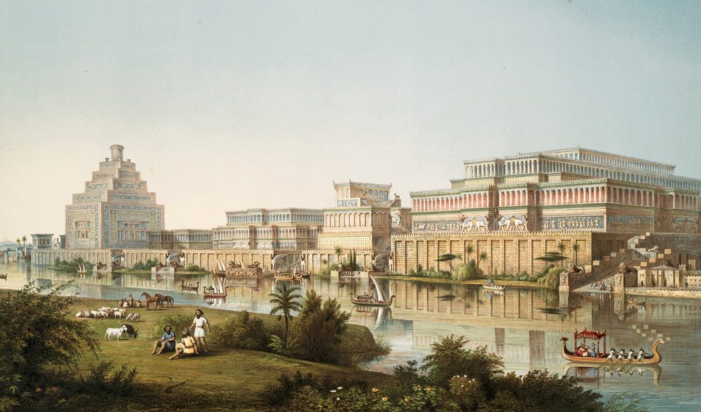
BYZANTIUM 1200
Thanks to this excellent artist for his amazing renditions of Babylon and Byzantium.
Honourable mentions also go to the following:
Vrenderings; Baz Battles; Exploring History; Archaeology Soup; Mark Millmore; World History.org;
Appendix 5
MISCELLANEOUS
Extremely rigorous research was involved in the creation of Timescapes, however, in a project of this scale there will inevitably be some mistakes and inaccuracies. Apologies for any of these – Timescapes invites users to submit serious suggestions regarding amendments to the maps. Please address these to the Timescapes Facebook Group at https://www.facebook.com/Timescapes-History-Maps-894070474130375
PLEASE NOTE:
Timescapes is an independent product and is not owned by, attached to, affiliated with, or endorsed by Google Earth or Google Earth Pro. All mentions of Google Earth in the Timescapes documentation are to merely in order to illustrate its suitability as a platform for the use of Timescapes map files.